This is Luke typing from the home of Larry and Kathy Dansky (Uncle Larry & Aunt Kathy) in State College, PA. Uncle Larry picked Caleb and me up from Hawk Mountain Road just past Port Clinton, PA, which is 1,222.4 miles from Springer Mountain, GA and 955.9 miles from Mt. Katahdin, ME.
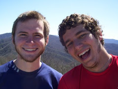
Let me start out by saying the McGowan family is awesome and made life easy for us at the psychological midway point of the trail! They treated us to some great meals (both home-cooked and at restaurants) and were so friendly and welcoming. We stayed with Kevin's brother for a couple of nights in Bethesda, MD and with Kevin's parents in Owings, MD for two days and the whole time was fantastic. Kevin's dad even said he would talk to his brother, who lives in Delaware Water Gap, PA, to see if he'd be willing to pick us up and give us a shower when we got into their neck of the woods. Sure enough, Uncle Doug has left a message on my voicemail wanting to know when we are coming through, so I am going to give him a call in the morning. The stay in Maryland was highlighted with many buffet restaurants, visits to 7/11 for a 60 oz. Slurpee after and before any activity, several movies, and some intense playing in the McGowan's backyard. Of course, the best part was having the chance to hang out with one of my best friends from college before he embarks into responsible life with an actual job on June 1st. Kevin has matured so beautifully... (Tears run down face)
But, as is always the case on this trip, we had to eventually leave the luxuries of civilized life and head back into the woods. Leaving Harper’s Ferry was really quite pleasant. It’s a quaint little town with tons of history. We passed Jefferson’s Rock, which overlooks the confluence of the Potomac and Shenandoah Rivers and was named after Thomas Jefferson, who was apparently inspired by the view back in the 18th century. Once we actually crossed the Potomac River and crossed into Maryland, we walked for several miles along the bank of the river on the smoothest, flattest part of the entire A.T. up to this point. We then hiked up to the Weverton Cliffs, which overlooked the whole stretch of trail that we had traveled on from Harper’s Ferry. We were planning on watching the sunset from the cliffs, but I realized that I had left my headlamp at Kevin’s house, so instead of witnessing a relaxing, beautiful sunset, I ended up jogging the two miles to the next shelter before dark.
There are only about forty miles of the trail in Maryland, but they were a memorable forty miles. It seemed as if the trail took us through the history of the land. There were neat monuments to those involved with the Civil War, and placards that marked the spots of battles, and we even saw the original Washington Monument! Not the famous one in D.C., but the first ever monument dedicated to George Washington which was constructed on top of a mountain in 1827 by the whole township of Boonsboro.
Leaving Maryland and entering Pennsylvania, we hiked our first 30-mile day. The terrain was just really easy, so it wasn’t something we really had to push for. We just got up early and started walking. In fact, we had time to enjoy the picnic pavilion at Pen Mar County Park for an hour, which was a beautiful park right on the state line of Maryland and Pennsylvania. An Amish family was playing on the jungle gym, which was something we weren’t expecting to see when we woke up that morning.
Pennsylvania gets a bad rap on the Appalachian Trail. For so long, we’ve heard about the infamous rocks and rattlesnakes that we will encounter in Pennsylvania. And while it is true that there are a ton of rocky sections in Pennsylvania and that we have come across one heck of a huge rattlesnake, there is more to Pennsylvania that other hikers leave out when they talk about it. No one ever mentioned to us the stretch of Pennsylvania where we actually get out of the mountains and walk through some beautiful farmland. No one on the trail talks about the wonderful parks in southern Pennsylvania that you walk through which allows you to see just how truly fun the outdoors can be with family and friends barbequing, Frisbee-tossing, and laughing. No one emphasizes that the miles can easily be hiked because you stay on a ridge for 12-15 miles at a time. We’ve just heard about the rocks, the rattlesnakes, and the half-gallon challenge that is at the midway point (eating a half-gallon of ice cream at the midway point of the trail – see photos and videos for a deeper understanding). But, take it from me; there is more to the trail in this state than just those things.
One bad thing about Pennsylvania, though, is that it is where Caleb has been feeling sick for about the past week. Let me first say that Caleb never normally complains. But for a few days he was complaining about headaches. And feeling hot. And then feeling cold five minutes later. And asking questions like, “Why do you think I’m so tired lately?” We both knew something was up. Sure enough, we look in my book for early symptoms of Lyme Disease (the infamous tick-borne disease) and they are headaches, fatigue, cold-chills, and fever. He continued to hike for a few days because, well, he’s Caleb. However, when his uncle, who is a doctor and lives in Pennsylvania, returned from a trip to Italy, Caleb called him and asked for his diagnosis and advice. Uncle Larry said there was no sure way of telling over the phone, but said we were only a couple hours away from his house and offered to come pick us up. Caleb had had a long night the night before (he’ll write about that in his post, I think) and I am always up for hiatuses from the trail, so Uncle Larry came and got us later that day. He brought us back to his house and has fed us, let us get clean again, bought us groceries, given Caleb some antibiotics for his tick-borne illness, and entertained us through and through. I’m a little jealous that Uncle Larry and Aunt Kathy are not my own Aunt and Uncle because they are just such great people. Aunt Kathy showed off what she learned in Italy and fixed us a hot Italian meal tonight and afterwards we played card games for a couple of hours before everyone went to bed and I got on here to do my blogging. After a zero-day here to let Caleb get some rest, the plan is to head back onto the trail tomorrow morning and to continue north towards Maine.
Once again, thanks for following our journey. Not only on here with the blog, but also with your voice messages on our phone that we have with us and things that get to me through my parents. Bryson clan – I hate I missed Taylor’s graduation party, but thanks for caring so much. Lawrence – thanks for making it through my last post and what you said really hit me. Renee – I got so excited when I saw that you left a comment! Trent – your voice messages pump me up so much. There really is too many to list, but just know that Caleb and I appreciate everyone’s support so much. One lesson I will definitely take from the trail is that no accomplishment means much without your friends and family to share it with.
So long,
NoseHose
 People say pennies are useless, but if I had a penny for every leg on each of the millipedes I've seen on this trip, I would never work another day in my life.

 These are photos of Gypsy-moths, which are actually a big problem for parts of the Appalachian Mountains. There's an overpopulation of these things and they eat all the healthy leaves off the trees. There have been signs posted in PA and southwest VA along the A.T. informing hikers that there will be airplanes dropping insecticides to help control the Gypsy-moth population.
 A view from "the Pinnacle," which is supposedly the best view in all of PA. At noon on a beautiful Saturday, I was more awestruck by the large crowd.
 My cat-food can stove hard at work
 For about three days in PA it looked like this all day
 Caleb crossing a bridge
 A family cemetery from the 1850s
 Crossing the Susquehanna River after pizza and groceries in Duncannon, PA...those clouds don't look good.
 Sunset through the trees
 Pennsylvania farmlands...nice to be off a mountain for a short time
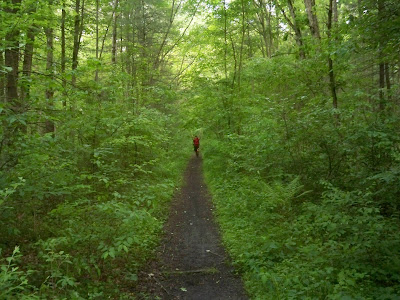 Caleb sprinting towards me on a flat portion of the trail
 The Midpoint Marker
 I'm in da' club!
 Pretending not to struggle during the half-gallon challenge
 An old building that was once used to store firearms during the Revolutionary War
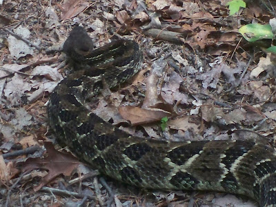

 Poisonous Snake
 a chipmunk
 Pennsylvania rocks
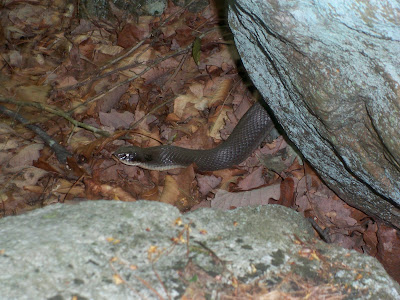 non-poisonous snake
 Spider that was in a shelter we decided not to sleep in
 Mason-Dixon Line, crossing into PA
 There's something about a sunrise in the woods...
 This is the position the trail-runner found us in on the Annapolis Rocks and said he had to take a picture. After the picture he said, "Only thru-hikers..."


 We spent about an hour on the Annapolis Rocks, the best view in Maryland
 The original Washington Monument
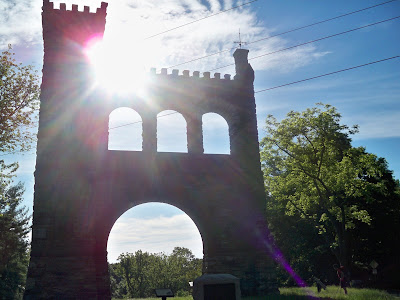 A memorial to the "correspondents of the Civil War"
 Our view from Weverton Cliffs of the Potomac River
 Crossing the Potomac River into Maryland